Take a whirlwind, three-hundred-year tour through the Anacostia's history, from natural treasure to garbage dump and back again.
The Anacostia Watershed Society is celebrating its 25th anniversary this year with a look back at the nonprofit's founding and even earlier. The AWS's vision for the river is to make it fishable and swimmable by the year 2025, but it's not the only vision that developers, activists and residents have had for the river over its 300-plus-year timeline of white settlement. So we decided to look at some of the visions for the river throughout the years.
Some are practical, some are fanciful. Some didn't stand a chance of being implemented even when they were first proposed (see the enormous spherical aquarium proposed for Kingman Island). But if you don't have vision, you don't have much.
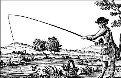 Not John Smith.Early years
 - Captain John Smith sailed up the "Eastern branch" of the Potomac in 1608 looking for the main branch of the river. The Anacostia Watershed Society says that "So full was the Anacostia with life, it is said Captain John Smith could dip a frying pan in its water and scoop out fish." Well, kind of. Smith does record attempting to catch fish with a frying pan, but he doesn't mention where in the Chesapeake Bay he was, and frying pans are terrible fishing gear even when there are "
neither better fish, more plenty, nor more variety for smal fish" than anywhere else. He did manage to
stab some fish in the Rappahannock with his sword, which mostly raises doubts about Smith's fishing know-how than anything else.
Okay, now we need to fast-forward a good three hundred years, to
1901.
Common lore says the Anacostia had always been a rather leisurely river--more like a tide marsh than an actual river. But actually, it was
three centuries of economic growth and the accompanying clear-cutting, dumping, and topsoil runoff that silted up the river. Either way, by the late 19th century, the Anacostia was a mess.
The 1901 report "The Improvement of the Park System of the District of Columbia" - better known as The McMillan Plan--
started off its
section on the Anacostia like this:
"The present outrageous condition of the Anacostia River has been so fully discussed before Congress in various reports during several years that there is no occasion for us to describe it in detail again."
It only gets better from there. "Within the District of Columbia the Anacostia is a fresh-water estuary with a normal tide of about 3 feet, which alternately covers and exposes to the suns a great area of reeking mud flats upon which the aquatic plants constantly entangle additional deposits of mud, slime, and putrifying organic matter."
Well, that sounds pleasant. The Commission recommended dredging the river to make it navigable again and "reclaiming" the mud flats. It envisioned a waterfront park with room for swimmers, skaters in winter, and of course boats.
The Army Corps of Engineers used the dredged-up silt to build Kingman and Heritage Islands, themselves subjects of many
visions that did not come to fruition (including one 30-year quixotic quest to build a theme park called "National Children's Island" there. Renderings of this park--which was to include a “
dynamic motion theater”; a hall of sports; a 150-by-70-foot model of the human body; cafés and elegant restaurants; and an “underwater world"--are hard to come by, if any exist at all, and the project was officially killed in 1999.)
At the same time, Anacostia Park emerged from the mud flats. But the river was on the decline.
By the
1950s, pollution and illegal dumping had pretty much wrecked the Anacostia. From 1942 until 1968, D.C. ran an incinerator in Kenilworth Park, just south of the Aquatic Gardens (there's a rec center there now). There was
all sorts of other pollution going on as well which we don't have to enumerate here. Suffice to say that "The Forgotten River" was a pretty good name for the Anacostia for a good chunk of the 20th century.
By
1989 when AWS was founded, there was finally some momentum to the idea that urban rivers didn't have to be disgusting. (The Clean Water Act was passed in 1972, a few years after the Cuyahoga River in Ohio famously caught fire, and people were starting to pay attention.) AWS spent years cleaning up trash, planting trees and organizing canoe trips.
Just a few years later in
1997, the National Capital Planning Commission released
Extending the Legacy, a vision for the entire city that saw some new ideas for the waterfront.
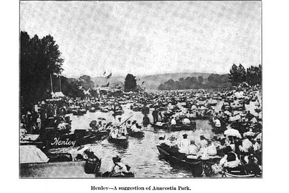
"A new water taxi system will link many points along both rivers, making it possible to go from an afternoon picnic at Poplar Point to an evening concert at the Kennedy Center without getting into a car." As of 2009 with the opening of Diamond Teague Park, it's now possible to take a water taxi into the Anacostia, but not--yet--from there to the Kennedy Center.
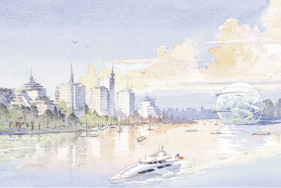
Perhaps the most important document in the Anacostia's recent history is the Anacostia Waterfront Initiative, which Mayor Anthony Williams released in
2000. The 30-year, $10-billion plan promised to "transform the shores of the Anacostia River into a world-class waterfront."
"The Anacostia River Corridor will unite the city economically, physically and socially as the center of 21st century Washington and a cornerstone of the National Capital Region," a 2003
supplementary document said.
Well, we're only halfway through that vision, so it's perhaps too early to tell, but there's certainly more work to be done. The river still isn't fishable or swimmable. The word "Anacostia" still conjures up terrifying visions to out-of-towners (but they also stand on the left side of Metro escalators, so what do they know?). And we're closer than we've been in years to success. Green roofs and other city-funded projects are drastically reducing runoff. The city is right now studying the toxics in the riverbottom to determine who pays to clean them up. Plastic bags, and soon Styrofoam trash, are on their way out of the river. The Anacostia Riverwalk Trail, which will connect Nationals Park to Historic Anacostia, RFK Stadium and the Arboretum, will be finished in 2016. Hundreds of boaters use the river and thousands enjoy it from the Capitol Riverfront's Yards Park. Given another 15 years, who knows?
This article has been updated to correct the year John Smith explored the Anacostia. It was 1608, not 1605.